Other than flying airplanes, I'm your basic mid-twenties computer junkie. I've always been a fan of Google, not only for their search engine technology but as a company not only sees the future of the Internet, but actually does something to make that happen.
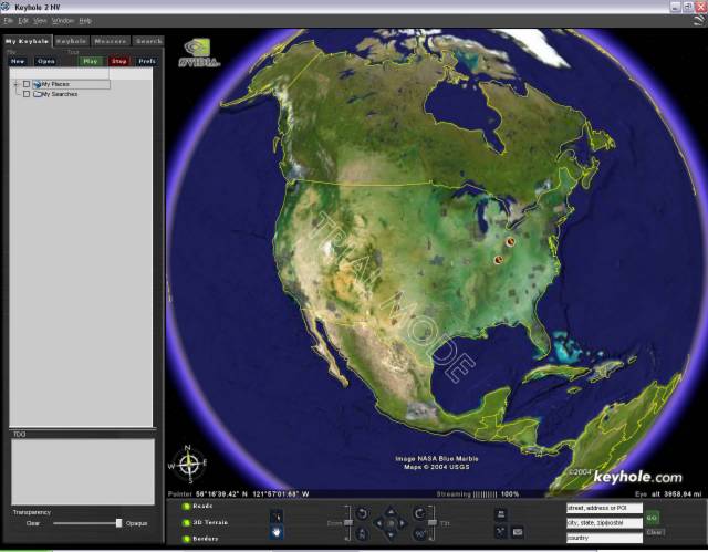
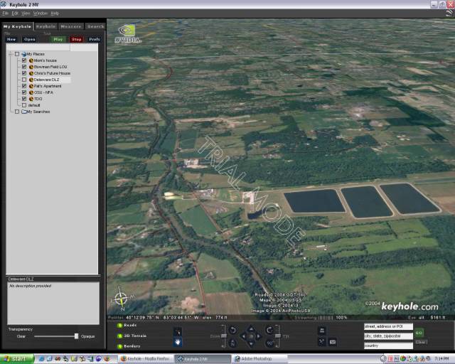
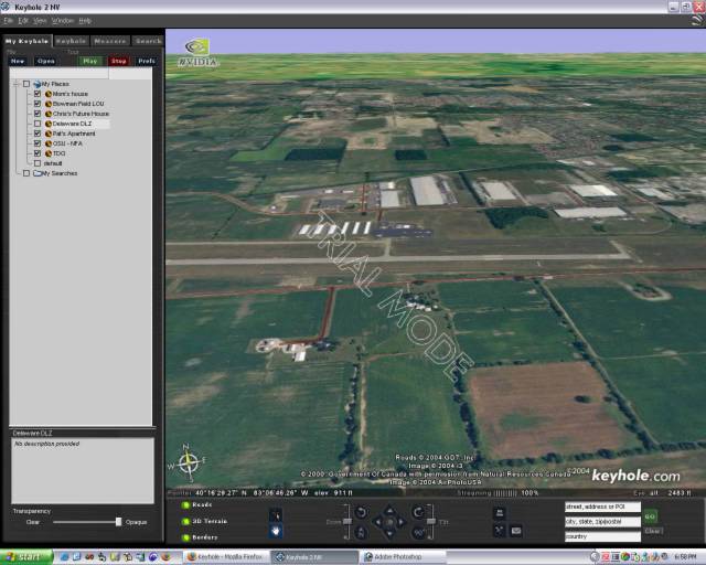
Recently they acquisitioned a software product called Keyhole, which they announced this week in their typical manner with a low-key link at the bottom of their main page. To describe Keyhole, it's a streaming source for high resolution satellite images from all over the planet. In cities where they're highest resolution is available (such as Columbus OH) you can zoom in down to street level with an amazing level of detail.
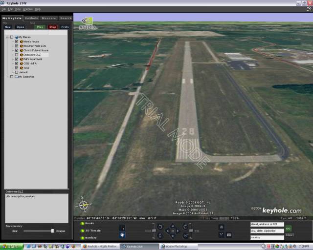
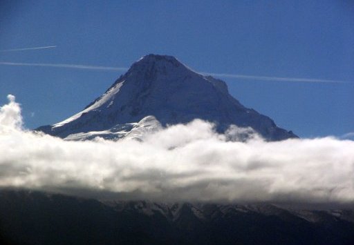
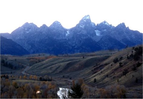
That sounds pretty neat, but what does it have to do with aviation? Well, choosing checkpoints on a sectional chart is one thing, but finding the checkpoint up in the air is a whole different manner, especially if it's the first time you're actually flying in the area. Keyhole enables you to actually see what the lake or town you'll fly near will look like. Using the tilt and rotation controls you can even position the view to show you what it'll look like from the direction you'll be flying from.
This type of visualization is critical. Finding the checkpoint is important, but as I learned recently from my last trip to Louisville, the relationship between your plane and the checkpoint you reach is vital in determining whether or not you're blowing off course.
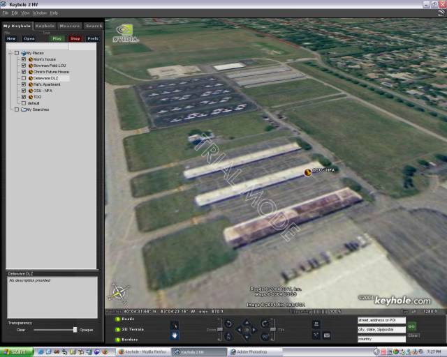
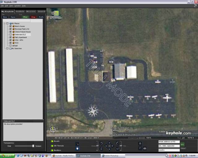
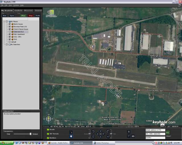
Keyhole also plays and important role in finding an airport. Airport and taxiway diagrams (assuming one is available for your destination, for many small fields there are not) can help you in figuring out runway lengths and orientation, available taxiways and such, but they cannot prepare you for what the airport will visually look like from your direction of flight. My first instructor told me that the second biggest lie in aviation is "I have the field." Well, using Keyhole you can prepare yourself by identifying visual cues that will help you quickly identify the field when you're in the sky.
Finally, to take it to the next step you can also virtually fly your entire flight plan from Keyhole. Pick your homefield and your destination and record the trip like a movie for later playback and study.
There are some limitations though, the highest "right-down to the street" resolution imagery is only available in certain cities, although they seem to be expanding the list like crazy, and there are a lot of areas that are "green zones" which only have terrain, road and river details, which is more like a visual rep of a sectional chart. In addition, the images aren't real time (of course) and there's a question of how recent the images are. For instance, a shot of Delaware's field (DLZ) showed where they recently repaved a taxiway, however when I looked up my friend Chris' house it just showed me an empty lot before they began construction.
These improvements are coming though, and it's going to happen soon. The applications for this technology are huge, although I think aviation has the most to gain from this, especially GA. Combine this with the GPS units and MFDs already being added to new GA aircraft, the availability of cheap and high quality flight planning (with real-time weather) software and the continued expansion of high-speed internet access, the information divide that separated the private pilot and the airline pilot previously is going to be a thing of the past.
A free trial of Keyhole is available for download at their website (
http://www.keyhole.com). The free trial for the personal edition is 7-days, with a year subscription running $29. They also have a version for nVidia enabled graphic cards.
Clear skies!