Saturday, October 23, 2004


Trip to Louisville (part 2)
The trip coming up was in some ways easier and harder. The big advantage flying up last Sunday was the weather, the sky was extremely clear and I had great visibility for the entire trip.
Getting to LOU I said my goodbyes to Daniel and my Mom and began to preflight the plane. Central American Airways already filled it up, all I had to do was to pay. Getting back to the airplanes I completed the preflight and went through the pre-start checklist. Keeping in mind my experiences starting the aircraft yesterday, I kept the fuel pump off which did the trick and started the Cherokee nicely.
I was third in line to takeoff, so I completed the runup and waited until it was my turn. Soon enough I was in the air and on my way back home.
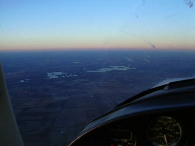
Keeping my course was pretty easy, still I was battling a stiff headwind which keeping my groundspeed down to 90 knots. Soon enough though I got to my checkpoint to call up Cincy's Class B, I was anxious to redeem myself from yesterday however when I called approach I got back this response.
"November 52 Tango, remain clear Class Bravo, contact me again in fifteen minutes..."
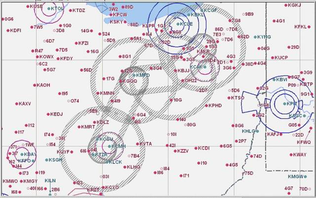
Uh-oh, looking over the chart I could see it would be tough to hold for fifteen minutes and still stay close to my course. Thinking it over I figured that it would be better to just divert around the Class B. I picked an airport on the perimeter to divert to, and picked an altitude that would keep me below Ciny's outer "shelf." After I made that airport I could turn back towards OSU and climb to a higher cruising altitude.
I went through the diversion procedures, charted a new course, timed it, checked my fuel and even plugged in the diversion airport to my VFR GPS. Listening to Cincy's frequency, it was very apparent that they were extremely busy, and it was best for everyone that I wasn't flying through it. :P
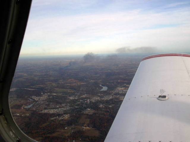
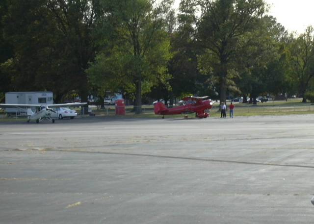
Flying to my new diversion checkpoint, and then back on course went without a hitch, although I had to keep a large crab angle in since my straight-on headwind turned into a left quartering headwind. The new course though took me over Clermont County, home of Sporty's, which gave me an opportunity to snap a picture of the field.
Because of the diversion, I was also using the VFR GPS to help keep my course (and distance to OSU), cross-checking with checkpoints. After I passed Summerford however I noticed the GPS was displaying OSU much closer than I was expecting (6 miles). Now OSU is Class D, which means I need to call the tower and establish communication before entering, and my GPS was telling me I was almost inside of it, while my VFR checkpoints and pilotage were saying something else.
Now here's where it got interesting, it was getting dark, my GPS was telling me I was almost home, however visually I could not see the city (visibility was good, however there was a haze in the distance) and my last checkpoint was telling me I was much farther away.
I circled around pondering what to do, I had a lake nearby which I could identify on my chart and I considered repeating the same trick I used on Saturday, basically plot a course from the lake to OSU. Now, that made a lot of sense, however the other part of my brain was saying "look, just fly the course on your GPS" and unfortunately I listened to that part first and wasted precious time chasing down that heading which cultivated with an embarrassing call to OSU tower. I misstated my position and basically they came back with "we don't have you, call us when you're within 5 miles."
By this time it was definitely dark, I was still close to my lake and I came to a realization. Basically I was looking for someone or something to tell me what to do, the GPS and the tower to tell me where I was. The realization I came to was that I and I alone could figure this out. That helped me to start thinking correctly and I started to evaluate my options again. The lake idea made sense, I knew it would work, and I knew that's what I should have done from the beginning.
Plotting the course from the center of the lake to OSU I flew over the lake and started my timer, suddenly the city became more visible, a couple of minutes later I could make out OSU's runway lights and flashing runway ending indication lights (REIL's). I called the tower again and they cleared me for landing, also reminding me that I needed to close my flight plan with the FSS when I got down.
Landing was uneventful, and I taxied back to park and secured the airplane, immediately I called my Mom and beat a path to NFA's office to call Dayton FSS. They were expecting me and wished me a goodnight. If things had gone really wrong up there I was glad I had filed a flight plan, especially since how close I came to getting lost.
So all in all my first cross-country after getting my license was a real learning experience. Flying is a process of continual learning, and while I made some mistakes during the flight (and some good decisions as well) I thinking I've learned from them and I grown as a pilot.
Getting to LOU I said my goodbyes to Daniel and my Mom and began to preflight the plane. Central American Airways already filled it up, all I had to do was to pay. Getting back to the airplanes I completed the preflight and went through the pre-start checklist. Keeping in mind my experiences starting the aircraft yesterday, I kept the fuel pump off which did the trick and started the Cherokee nicely.
I was third in line to takeoff, so I completed the runup and waited until it was my turn. Soon enough I was in the air and on my way back home.
Keeping my course was pretty easy, still I was battling a stiff headwind which keeping my groundspeed down to 90 knots. Soon enough though I got to my checkpoint to call up Cincy's Class B, I was anxious to redeem myself from yesterday however when I called approach I got back this response.
"November 52 Tango, remain clear Class Bravo, contact me again in fifteen minutes..."
Uh-oh, looking over the chart I could see it would be tough to hold for fifteen minutes and still stay close to my course. Thinking it over I figured that it would be better to just divert around the Class B. I picked an airport on the perimeter to divert to, and picked an altitude that would keep me below Ciny's outer "shelf." After I made that airport I could turn back towards OSU and climb to a higher cruising altitude.
I went through the diversion procedures, charted a new course, timed it, checked my fuel and even plugged in the diversion airport to my VFR GPS. Listening to Cincy's frequency, it was very apparent that they were extremely busy, and it was best for everyone that I wasn't flying through it. :P
Flying to my new diversion checkpoint, and then back on course went without a hitch, although I had to keep a large crab angle in since my straight-on headwind turned into a left quartering headwind. The new course though took me over Clermont County, home of Sporty's, which gave me an opportunity to snap a picture of the field.
Because of the diversion, I was also using the VFR GPS to help keep my course (and distance to OSU), cross-checking with checkpoints. After I passed Summerford however I noticed the GPS was displaying OSU much closer than I was expecting (6 miles). Now OSU is Class D, which means I need to call the tower and establish communication before entering, and my GPS was telling me I was almost inside of it, while my VFR checkpoints and pilotage were saying something else.
Now here's where it got interesting, it was getting dark, my GPS was telling me I was almost home, however visually I could not see the city (visibility was good, however there was a haze in the distance) and my last checkpoint was telling me I was much farther away.
I circled around pondering what to do, I had a lake nearby which I could identify on my chart and I considered repeating the same trick I used on Saturday, basically plot a course from the lake to OSU. Now, that made a lot of sense, however the other part of my brain was saying "look, just fly the course on your GPS" and unfortunately I listened to that part first and wasted precious time chasing down that heading which cultivated with an embarrassing call to OSU tower. I misstated my position and basically they came back with "we don't have you, call us when you're within 5 miles."
By this time it was definitely dark, I was still close to my lake and I came to a realization. Basically I was looking for someone or something to tell me what to do, the GPS and the tower to tell me where I was. The realization I came to was that I and I alone could figure this out. That helped me to start thinking correctly and I started to evaluate my options again. The lake idea made sense, I knew it would work, and I knew that's what I should have done from the beginning.
Plotting the course from the center of the lake to OSU I flew over the lake and started my timer, suddenly the city became more visible, a couple of minutes later I could make out OSU's runway lights and flashing runway ending indication lights (REIL's). I called the tower again and they cleared me for landing, also reminding me that I needed to close my flight plan with the FSS when I got down.
Landing was uneventful, and I taxied back to park and secured the airplane, immediately I called my Mom and beat a path to NFA's office to call Dayton FSS. They were expecting me and wished me a goodnight. If things had gone really wrong up there I was glad I had filed a flight plan, especially since how close I came to getting lost.
So all in all my first cross-country after getting my license was a real learning experience. Flying is a process of continual learning, and while I made some mistakes during the flight (and some good decisions as well) I thinking I've learned from them and I grown as a pilot.
Sunday, October 17, 2004


Trip to Louisville (part 1)
Well, last week I flew down to Louisville to see my mom and my brothers. I had a lot of reasons for flying down instead of driving. Mainly I wanted to take a cross-country since I got my license, fly through a Class B, go through the process of opening and using a flight plan, and getting more familar with the Cherokee 180 in our club.
There was some doubt about the weather due to a weak cold front moving in, so I called mom on Friday night, basically telling here I'll give her a call before I left letting her know if I would be driving or flying. Early Saturday morning I finished up my planning and checked the weather, it was still up in the air, the good news is that the time frame I was flying down was mostly VFR, the IFR stuff would move into Ohio close to noon. So I called the weather briefer, who cleared up some points, mainly that the forcasts were prediciting slightly worse weather than what was developing. So I filed a flight plan, called mom and set out towards the airport.
Doug was there and since it was the first time we saw each other since the fly out we talked a bit, he's done with the FAA requirments and just has to take the written and the practical/oral exams. Preflighting 2652T was pretty routine, however like last time starting was tricky. I finally got the engine to catch by leaning the mixture and keeping the throttle wide open. I figured maybe the spark plugs were fouled, so I kept the mixture lean while I finished up the engine start and pre-taxi checklist. Run-up went normally and the engine was doing great, I called the tower and got my takeoff clearance and was up in the air in no time.
Leaving OSU it came fairly apparent that the visibility would keep me from flying very high, I kept it at 3000, which seemed to give me about 7 miles of visibilty. Keeping in mind the lower visibilty I stayed vigilant with the checkpoints, however I still ended up drifting off course, the tell-tale being that I was on the wrong side of a lake that I was using as a checkpoint.
Thinking about how to get back on course, I just planned a diversion, using directly above the lake as my point of origin and my next checkpoint as the destination. That worked pretty well and I got back on course just in time to call Cincy approach.
Now the B in Class B stands for BUSY, and it would be my first time through Class B solo (I've flew through Class C solo). The radio procedures are the same, the big difference is that the controllers in Class B have to explicitly give you clearance. In Class C and D airspaces you just have to establish two-way communication (they read back your callsign). I made it through without too much trouble, the controllers were pretty paitent with me, considering a couple of times I missed some radio calls. I got thrown at first because they preceded my call number with "November," now that's my aircraft full registration number N-2652T, but I wasn't used to anybody actually using it, normally the N is implied and you hear something like "Cherkoee 2652 Tango" or even "52 Tango." Once I figured it out I was able to respond to their requests better.
Good thing about going through Class B or Class C is that they vector you through to where you want to go, unfortunately they also vector you off a direct path, so you may end up far off your orignal course which plays havoc with your neat checkpoints. I ended up in Indiana flying South towards Louisville. Fortunately I had alot of tools available to establish my new position, and to stay on course towards Louisville. I had the VFR GPS unit in the Cherokee, also Bowman field has a VOR right on the field. Basically I just had to dial the VOR frequency, set my CDI needle and fly keeping that needle centered up.
The visibility improved too, and so the rest of the flight was pretty relaxing and I was able to dig out the camera and take some pictures of the Ohio River. Unfortunately the visibility wasn't good enough to get a shot of Louisville's skyline (which I really wanted, Louisville has a very impressive skyline when you come from Indiana).
After I landed at Bowman, I called ground and got instructions on how to get to Central American Airways. I was planning to use Triangle Flying Service, but when I called down there before leaving they told me they had lost their ramp space :(. That sucks, because I started my flight training at Triangle with Southern Air Flying Club. I meant to ask around at what happened but I got sidetracked with a minor annoyance.
Okay, since I wasn't used to Central American, I taxied and parked to the closest tiedown I could find and hiked on foot to their front office. They bascially told me I could park overnight bascially anywhere there was an open spot (no reserved tie-downs for airplane owners on the field??) and I filled out a fuel card for Sunday. Well getting back to the plane to tie it down I noticed there were no chains. Well there where, but they chain spots didn't fit my plane and there was no tail tie-down. Uh oh, so I climbed back in and tried to start the plane.
It wouldn't start . . .
No problem, this is 2652T, the hardest plane in the flying club's fleet to start. I leaned the mixture, applied full throttle and tried again, still nothing. I checked the makeshift ammeter guage . . . which showed just above 2 volts.
The master switch was one and there was no power. Super. I got out and flagged a fuel truck, asking if I could get a tow to another tie-down. He radioed it in and I went back to the plane and waited, and waited, and waited.
My mom was on her way and from the way it was looking I wasn't going to get the plane secured anytime soon. While I was waited I decided to try at starting the plane again. Switching off the alternator side of the master switch reveled that on battery power I could get almost 12 volts.
Thinking through how I could get more power I switched off the electric fuel pump, cranking the mags it sounded like the engine was pretty close to catching. Trying again and really working the throttle the engine roared to life! Sweet! I throttled down to 1000 rpm, watching the ammeter and switched on the fuel pump, the volts stayed up. Checking the load with the alternator and the battery the volts stayed normal at 15. Relieved I taxied to a better tie-down and as soon as I did came a lineman with a tow.
All well, I apologized, got the plane secured and finally met my mom in the parking lot who was paitently waiting for me.
So how much time did I save flying down? Well I left my apartment at 8 and I got in my mom's car at 12. :P Four hours, exactly the same time I would have taken to just drive down. The only difference was my butt wasn't sour since I was in the seat less (about two hours). My time was eaten up by the fact that I had to preflight the plane, and getting prepared for taking off. I was about an hour before I could actually get up in the air, and the whole parking thing at Central ate up at least thirty minutes.
Still it was pretty fun, and I got to do alot of the things I wanted to do, and I was less bored during the trip. I was surprised how easy it was to file a flight plan, open and close one. The process was really simple, in fact any future long cross-country trips like that I plan to use VFR flight plans with the FSS often.
Part two will cover my trip back home to Ohio...
Friday, October 01, 2004
Ohio TFRs for October 2nd
As election day draws nearer, the TFRs (Temporary Flight Restrictions) in Ohio have been getting more and more frequent. Fortunately AOPA is excellent at letting its members know when a TFR may affect their area, usually 24 hours beforehand. Here's the latest one concerning Pres. Bush's bus tour through northern and middle Ohio tomorrow. The cities affected are Columbus, Mansfield, and Cuyahoga Falls.
The offical TFR NOTAM can be found here. Also a convient list of Ohio airports affected by the TFR.
On a personal note, I think joining the AOPA has been one of the smartest things I've done aviation wise. The TFR notifications (and visual and plain langague interpretations) pays for the membership itself.
Not to mention I get a snazzy blue AOPA hat.
Subscribe to:
Posts (Atom)
